Aree sosta camper per località › Stati Uniti › California

Death Valley: aree sosta e campeggi per camper – Bishop, Lone Pine

A Death Valley (California, Stati Uniti) ci sono 7 aree sosta camper, 74 campeggi, 7 parcheggi camper e 4 aree di servizio. Eccole qui, con tutto quello che sappiamo su corrente, acqua, scarico e le opinioni degli altri. Tutto è anche sulla mappa, dove puoi aggiungere i posti al tuo viaggio.

🚐 Pianifica un viaggio qui 🗺️ Mostra sulla mappa 🌤️ Meteo a Death Valley
🚐 7 aree sosta camper 🏕 74 campeggi 🅿️ 7 parcheggi camper 🛻 4 aree di servizio
Boulder Creek RV Resort

🏕 Boulder Creek RV Resort

Campeggio · 95,9 km da Death Valley

Ideally situated near Mt. Whitney & Alabama Hills, Boulder Creek RV Resort offers a convenient overnight stay with pull-through sites and full hook-ups including 30/50amp. Enjoy the on-site market and a Club House with kitchen, where you can relax with free …

⚡ Corrente🚻 Bagno📶 Wi-Fi🐕 Cani benvenuti
Mostra sulla mappa →
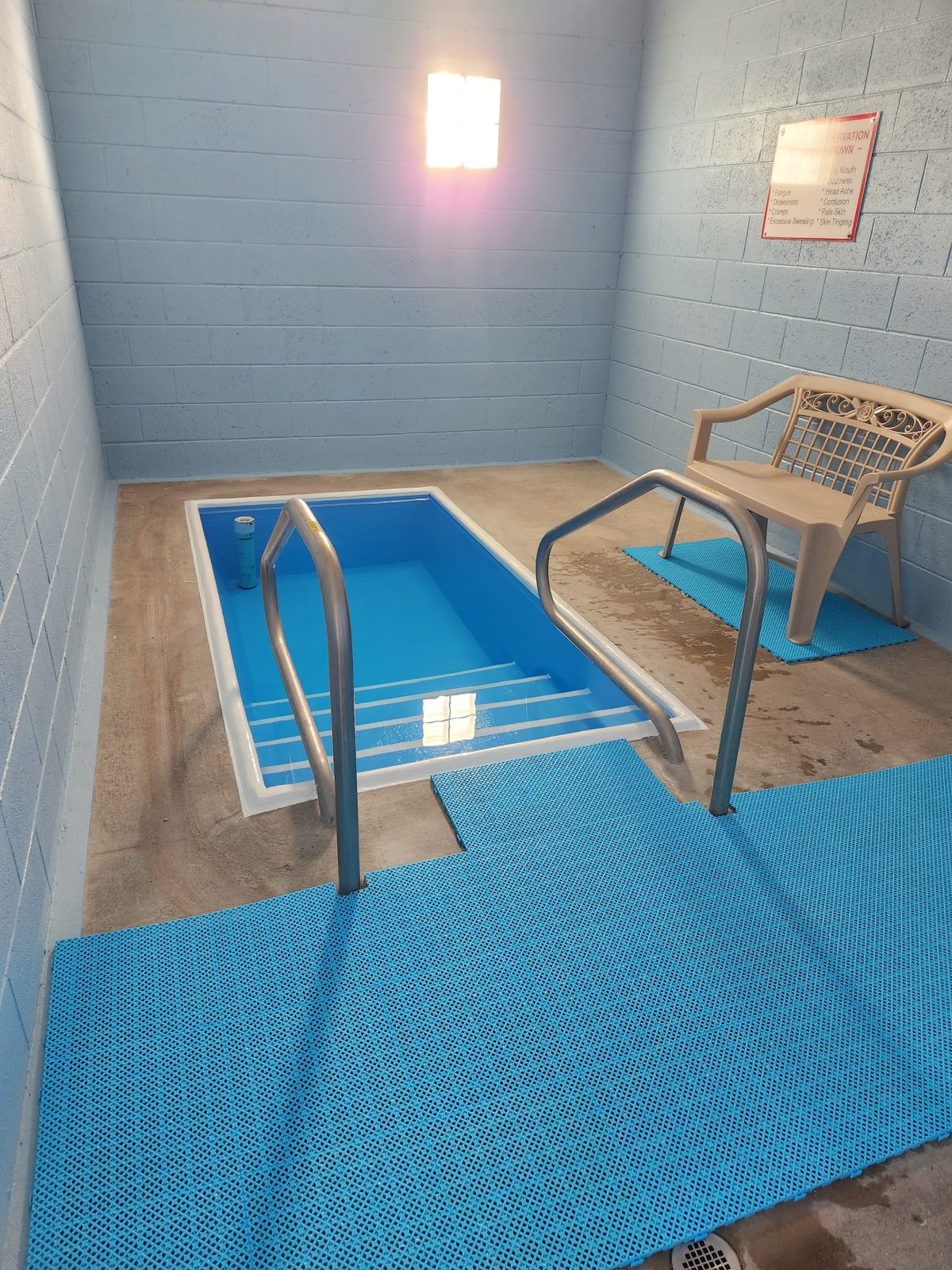
Tecopa Palms Therapeutic Hot Springs Resort

🅿️ Tecopa Palms Therapeutic Hot Springs Resort

Parcheggio camper · 252,3 km da Death Valley

Experience a quiet therapeutic resort stay with full hookups and concrete slabs, priced at 75 USD nightly. Your stay includes mineral hot spring passes, and a laundry room is available for 3 USD per load. Check-in is at 15:00, with the open season running …

📶 Wi-Fi🐕 Cani benvenuti
Mostra sulla mappa →
Mappa: Independence Creek Campground

🏕 Independence Creek Campground

Campeggio · 64,9 km da Death Valley

Located in a rural setting in Inyo County, California, Independence Creek Campground offers an outdoor overnight stop with tent camping facilities and creek-side scenery.

💧 Acqua🚻 Bagno
Mostra sulla mappa →
Mappa: Portuguese Joe Campground

🏕 Portuguese Joe Campground

Campeggio · 89,4 km da Death Valley

Located in Inyo County, California, Portuguese Joe Campground is a convenient overnight stop for travelers exploring the region. Managed by Inyo County Parks & Recreation, the site provides a reliable place to rest along your journey through this scenic part …

💧 Acqua🚻 Bagno
Mostra sulla mappa →
Mappa: Sunset Campground

🏕 Sunset Campground

Campeggio · 168,3 km da Death Valley

Located in Inyo County, California, Sunset Campground serves as a convenient overnight stop. Travellers will find the desert landscape provides a straightforward base for an evening stay in this region.

💧 Acqua🚻 Bagno
Mostra sulla mappa →
Mappa: Horton Creek Campground

🏕 Horton Creek Campground

Campeggio · 16,3 km da Death Valley

Horton Creek Campground is located in Inyo County, California. It sits near the town of Bishop in the eastern Sierra Nevada, along Horton Creek where bighorn sheep sometimes appear on the steep canyon walls and rainbow trout swim in pools below small …

🚻 Bagno
Mostra sulla mappa →
Mappa: Four Jeffrey Campground

🏕 Four Jeffrey Campground

Campeggio · 20 km da Death Valley

Four Jeffrey Campground is a campsite located in Inyo County, California, United States. This area sits in the eastern Sierra Nevada, near the town of Bishop along U.S. Route 395. Visitors can explore the nearby Buttermilk Country rock formations for …

🚻 Bagno
Mostra sulla mappa →
Mappa: Forks Campground

🏕 Forks Campground

Campeggio · 20,2 km da Death Valley

Forks Campground is a stop located in Inyo County, California, United States. It sits at the confluence of the Bishop Creek's Middle and South Forks in the Sierra Nevada, surrounded by rugged alpine terrain. Anglers cast for rainbow and brown trout in the …

🚻 Bagno
Mostra sulla mappa →
Mappa: Bishop Park Campground

🏕 Bishop Park Campground

Campeggio · 22,2 km da Death Valley

Bishop Park Campground in Inyo County, California, United States, serves as an overnight stop. No notable facilities or prices are listed. Situated in a rural setting, it accommodates travellers seeking a basic place to stop.

💧 Acqua
Mostra sulla mappa →
Mappa: North Lake Campground

🏕 North Lake Campground

Campeggio · 25,4 km da Death Valley

North Lake Campground in Inyo County, California, United States, is a stop where the facts are simply its name and location, so that is all we state for the place itself. It sits in the Bishop Creek Canyon area below the Sierra Nevada peaks, near North Lake …

🚻 Bagno
Mostra sulla mappa →
Mappa: Tinemaha Creek Campground

🏕 Tinemaha Creek Campground

Campeggio · 36,3 km da Death Valley

Tinemaha Creek Campground is located in Inyo County, California, United States. The campground sits along the creek of the same name in the Owens Valley, where travellers can see the rugged eastern escarpment of the Sierra Nevada and watch water flow through …

🚻 Bagno
Mostra sulla mappa →
Mappa: Taboose Creek Campground

🏕 Taboose Creek Campground

Campeggio · 42,3 km da Death Valley

Located in a rural California setting, Taboose Creek Campground offers an overnight stop with basic facilities. Pitch your tent under the trees and sleep by the creek before hitting the trail. No fee is charged.

🚻 Bagno
Mostra sulla mappa →
Mappa: Lone Pine Campground

🏕 Lone Pine Campground

Campeggio · 86,9 km da Death Valley

Set within Inyo County, California, Lone Pine Campground serves as an ideal overnight stop for travelers exploring the region. As an official recreation area within Inyo National Forest, it provides a convenient and natural resting spot to recharge before …

💧 Acqua
Mostra sulla mappa →
Mappa: Mount Whitney Trailhead Campground

🏕 Mount Whitney Trailhead Campground

Campeggio · 87,2 km da Death Valley

Mount Whitney Trailhead Campground in Inyo County, California, United States, is an excellent overnight stop for hikers preparing to tackle the high country. Remember that permits are required for this area, so secure yours in advance before arriving to enjoy …

💧 Acqua
Mostra sulla mappa →
Mappa: Tuttle Creek Campground

🏕 Tuttle Creek Campground

Campeggio · 91,7 km da Death Valley

Tuttle Creek Campground in Inyo County, California, is a convenient year-round overnight stop. At $12 per night, sites are first-come, first-served with no reservations accepted. RVs up to 30 ft are welcome, though there are no hook-ups. A group site and …

🧺 Scarico
Mostra sulla mappa →
Mappa: Olancha Resort

🏕 Olancha Resort

Campeggio · 128,3 km da Death Valley

Stay at Olancha Resort, a gateway to Death Valley and Mt. Whitney featuring a handmade Tipi Village and an RV park with full hookups. Enjoy stargazing and mountain views at this pet-friendly location. Check-in is at the on-site Olancha Café and general …

⚡ Corrente
Mostra sulla mappa →
Mappa: Emigrant Campground

🏕 Emigrant Campground

Campeggio · 140,9 km da Death Valley

Emigrant Campground in Inyo County, California, offers a simple overnight stop for travelers with standard vehicle access. To reach the site along Lower Wildrose Road, expect narrow road conditions with soft shoulders and rough gravel. Despite potholes, the …

💧 Acqua
Mostra sulla mappa →
Mappa: Glacier Lodge Campground

🏕 Glacier Lodge Campground

Campeggio · 26,8 km da Death Valley

In Inyo County, California, Glacier Lodge Campground offers RV and tent camping with full sewer hookups. Check in at the General Store, which offers food and is open most of the day. Fish in Big Pine Creek using the fish cleaning station, or hike to Big Pine …

Mostra sulla mappa →
Mappa: Eureka Dunes Campground

🏕 Eureka Dunes Campground

Campeggio · 68,9 km da Death Valley

Located in Inyo County, California, Eureka Dunes Campground offers an overnight stop for travellers exploring the remote desert landscape. Enjoy primitive camping with picnic tables and fire rings. No fee is listed for this rustic experience.

Mostra sulla mappa →
Mappa: Mesquite Spring Campground

🏕 Mesquite Spring Campground

Campeggio · 100,8 km da Death Valley

Located in Inyo County, California, Mesquite Spring Campground serves as an overnight stop in a rural desert setting, providing basic camping facilities for travelers visiting the region.

Mostra sulla mappa →
Mappa: Horseshoe Meadow Equestrian Camp

🏕 Horseshoe Meadow Equestrian Camp

Campeggio · 103 km da Death Valley

This equestrian camp in a rural setting provides facilities for horse camping, making it a practical overnight stop for travellers with animals in the county.

Mostra sulla mappa →
Mappa: Panamint Springs Resort Camping & RV

🏕 Panamint Springs Resort Camping & RV

Campeggio · 139,9 km da Death Valley

Panamint Springs Resort Camping & RV is located in a rural setting in Inyo County, California, United States, providing camping and RV options for an overnight stop.

📶 Wi-Fi
Mostra sulla mappa →
Mappa: Wildrose Campground

🏕 Wildrose Campground

Campeggio · 161,7 km da Death Valley

Wildrose Campground is located in a rural setting in Inyo County, California, United States. It offers a practical option for an overnight stop with basic camping facilities available for travellers.

Mostra sulla mappa →
Mappa: Furnace Creek Campground

🏕 Furnace Creek Campground

Campeggio · 167,5 km da Death Valley

Furnace Creek Campground in Inyo County, California, United States, offers travelers a convenient overnight stop. Before visiting this desert destination, be sure to check current road conditions due to recent flood damage, ensuring a safe and smooth arrival …

Mostra sulla mappa →
Mappa: Texas Springs Campground

🏕 Texas Springs Campground

Campeggio · 168,9 km da Death Valley

Located in Inyo County, California, Texas Springs Campground provides an ideal setting for an overnight stop, offering standard camping facilities surrounded by the region's scenic landscapes.

Mostra sulla mappa →
Mappa: Thorndike Campground

🏕 Thorndike Campground

Campeggio · 171,1 km da Death Valley

Situated in a rural setting in Inyo County, California, Thorndike Campground provides a practical overnight stop. Settle into the natural environment and take advantage of the basic facilities available for a straightforward stop.

Mostra sulla mappa →
Mappa: Mahogany Flat Campground

🏕 Mahogany Flat Campground

Campeggio · 171,7 km da Death Valley

Mahogany Flat Campground is a primitive campground in Death Valley National Park, Inyo County, California, United States. Ideal for a high-elevation overnight stop, it is open year-round with no reservations. There is no potable water, so you must pack out …

Mostra sulla mappa →
Mappa: Fiddlers' Campground

🏕 Fiddlers' Campground

Campeggio · 167,9 km da Death Valley
🚿 Doccia📶 Wi-Fi
Mostra sulla mappa →
Mappa: Big Pine Canyon - Palisade Glacier Group Campground

🏕 Big Pine Canyon - Palisade Glacier Group Campground

Campeggio · 26,2 km da Death Valley
Mostra sulla mappa →

Mostriamo i 60 posti di cui sappiamo di più, su 92 totali. Tutti i 92 sono sulla mappa →

Dati da OpenStreetMap, i siti web dei posti stessi e gli utenti Stop4Sun. Qualcosa non va? Apri il posto sulla mappa e correggilo.
Altri posti →