Postoje dla kamperów wg miejsca › Dania › Nordjylland

Frederikshavn: postoje dla kamperów i kempingi – Skagen

W Frederikshavn (Nordjylland, Dania) jest 10 postoje dla kamperów, 21 kempingi, 2 parkingi dla kamperów i 25 miejsca odpoczynku. Oto one, z informacjami o prądzie, wodzie, zrzucie nieczystości i opiniach innych. Wszystko też na mapie, gdzie możesz dodać miejsca do swojej trasy.

🚐 Zaplanuj trasę tutaj 🗺️ Pokaż na mapie 🌤️ Pogoda w Frederikshavn
🚐 10 postoje dla kamperów 🏕 21 kempingi 🅿️ 2 parkingi dla kamperów 🛻 25 miejsca odpoczynku
Svalereden Camping & Hytteby

🏕 Svalereden Camping & Hytteby

Kemping · 40,3 km od Frederikshavn

Situated in the northern reaches of Denmark, Svalereden Camping & Hytteby serves as a convenient overnight halt for motorhome and caravan travellers exploring the region. You can easily park your rig or pitch a tent with full access to electricity, water, …

⚡ Prąd💧 Woda🚻 Toaleta🚿 Prysznic📶 Wi-Fi🐕 Psy mile widziane
Pokaż na mapie →
Poul Eeg Camping

🏕 Poul Eeg Camping

Kemping · 1,8 km od Frederikshavn

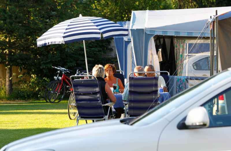
Poul Eeg Camping welcomes motorhome travellers looking for a convenient overnight stop in the northern reaches of Denmark. Situated within Frederikshavn Municipality, the site provides an accessible resting point that allows you to comfortably park your …

Pokaż na mapie →
First Camp Grenen Strand - Skagen

🏕 First Camp Grenen Strand - Skagen

Kemping · 2,2 km od Frederikshavn

Set near the coast in the North Denmark Region, First Camp Grenen Strand - Skagen offers a convenient overnight stop for motorhome and caravan travellers passing through Frederikshavn Municipality, with dedicated spaces to park your vehicle and easy access to …

📶 Wi-Fi🐕 Psy mile widziane
Pokaż na mapie →
Mapa: Udsigtspost Øksnebjerg

🛻 Udsigtspost Øksnebjerg

Miejsce odpoczynku · 37,3 km od Frederikshavn · ★ 4,8 (128 opinii)

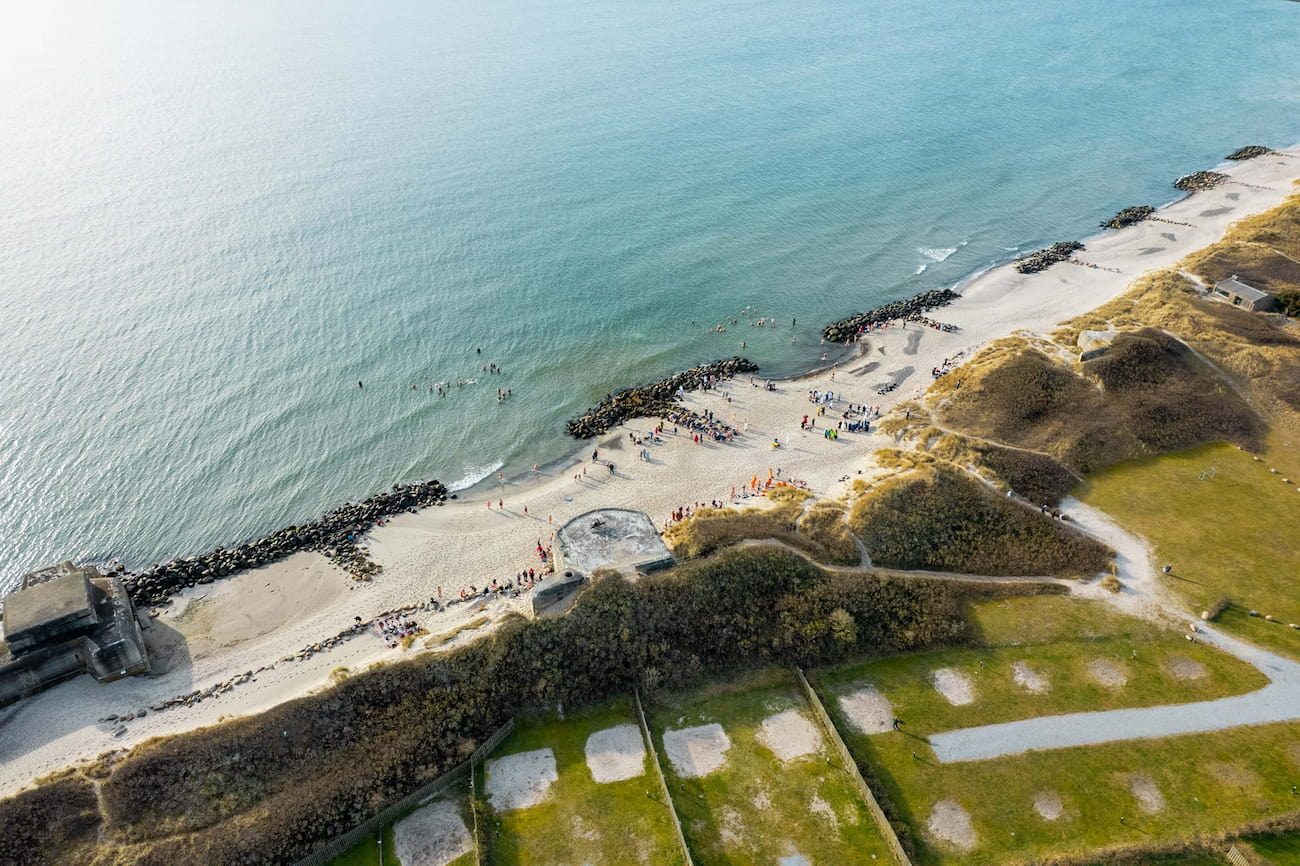
Udsigtspost Øksnebjerg is a rest area in Frederikshavn Municipality, North Denmark Region, Denmark. The stop sits on the elevated ridge of Øksnebjerg, which rises as one of the highest points on the island of Vendsyssel-Thy, formed by an Ice Age moraine. …

Pokaż na mapie →
Mapa: Knasborg Å

🏕 Knasborg Å

Kemping · 19,1 km od Frederikshavn · ★ 4,8 (11 opinii)

Knasborg Å is a campsite in Frederikshavn Municipality, North Denmark Region, Denmark. The coastal landscape here features the shallow waters of the Ålbæk Bay, where sandy shores meet the Kattegat sea and pine plantations stretch inland along narrow tracks …

Pokaż na mapie →
Mapa: Skagen Klitplantage - Hulsigstien Shelter

🏕 Skagen Klitplantage - Hulsigstien Shelter

Kemping · 4 km od Frederikshavn · ★ 4,7 (30 opinii)

For a rustic overnight stop in Frederikshavn Municipality, hike 700 m from Sandmilen parking to reach Skagen Klitplantage - Hulsigstien Shelter. No booking is needed. The two shelters sleep six each, and tents are allowed nearby. Enjoy a grill and fire pit, …

💧 Woda🚻 Toaleta
Pokaż na mapie →
Mapa: Tesla Supercharger

🛻 Tesla Supercharger

Miejsce odpoczynku · 37 km od Frederikshavn · ★ 4,6 (61 opinii)

The Tesla Supercharger is a rest area located in Frederikshavn Municipality, in the North Denmark Region of Denmark. The municipality sits along the Kattegat strait, where the coast is marked by pale sandy beaches and ferry harbours. At the nearby Port of …

Pokaż na mapie →
Mapa: XL-BYG Elling Tømmerhandel A/S

🛻 XL-BYG Elling Tømmerhandel A/S

Miejsce odpoczynku · 27,7 km od Frederikshavn · ★ 4,5 (503 opinii)

XL-BYG Elling Tømmerhandel A/S is a rest area located in Frederikshavn Municipality, North Denmark Region, Denmark. This spot lies near the village of Elling, which sits along the shallow waters of the Kattegat, where a forested river valley meets the flat …

Pokaż na mapie →
Mapa: Knivholt hovedgård

🏕 Knivholt hovedgård

Kemping · 31,1 km od Frederikshavn · ★ 4,5 (357 opinii)

Knivholt hovedgård is a campsite in Frederikshavn Municipality, North Denmark Region, Denmark. The site lies near the Kattegat coast, where rocky shores and sandy coves shape the shoreline. Walk to the Palmestranden beach or explore the historic harbour town …

Pokaż na mapie →
Mapa: Et hav af liv

🚐 Et hav af liv

Postój dla kampera · 43,5 km od Frederikshavn · ★ 4,5 (72 opinii)

Et hav af liv is a caravan site in Frederikshavn Municipality in the North Denmark Region of Denmark. This coastal stretch looks out over the Kattegat, where the first morning light hits the water and you can watch ferries glide toward Norway; the Ice Age …

Pokaż na mapie →
Mapa: Rørbæk Automotive A / S, Frederikshavn

🛻 Rørbæk Automotive A / S, Frederikshavn

Miejsce odpoczynku · 29,9 km od Frederikshavn · ★ 4,4 (99 opinii)

Rørbæk Automotive A / S is a rest area located in Frederikshavn Municipality in the North Denmark Region of Denmark. Situated near the town of Frederikshavn, it lies close to the Kattegat coast, where the sea meets the eastern Jutland shoreline, and …

Pokaż na mapie →
Mapa: Nature camping deck dunes Milevej

🏕 Nature camping deck dunes Milevej

Kemping · 13,5 km od Frederikshavn · ★ 4,4 (35 opinii)

Located in Frederikshavn Municipality, Nature camping deck dunes Milevej is an ideal overnight stop for cyclists traveling near the West Coast Cycle Route. Since there is no car access to site, it offers a peaceful retreat featuring free primitive camping, 2 …

Pokaż na mapie →
Mapa: Rasteplads Sørå

🛻 Rasteplads Sørå

Miejsce odpoczynku · 60,9 km od Frederikshavn · ★ 4,4 (7 opinii)

Rasteplads Sørå is a rest area located in Frederikshavn Municipality in the North Denmark Region of Denmark. It stands at the Sørå canal, a straightened waterway draining the surrounding flat farmland toward the Kattegat coast. Visitors can observe the …

Pokaż na mapie →
Mapa: Understed Forsamlingshus

🛻 Understed Forsamlingshus

Miejsce odpoczynku · 39,9 km od Frederikshavn · ★ 4,2 (15 opinii)

Understed Forsamlingshus is a rest area in Frederikshavn Municipality, North Denmark Region, Denmark. This spot sits in the coastal landscape near the Ålbæk Bay and the dune-covered isthmus of Grenen, where the Skagerrak and Kattegat seas meet. From here, …

Pokaż na mapie →
Mapa: Sport Outlet

🛻 Sport Outlet

Miejsce odpoczynku · 27,4 km od Frederikshavn · ★ 3,6 (5 opinii)

A rest area called Sport Outlet is located in Frederikshavn Municipality, in the North Denmark Region of Denmark. This spot sits within striking distance of the Kattegat Sea, whose Danish coastline here is shaped by pale sandy beaches and dunes. From nearby …

Pokaż na mapie →
Mapa: Kunstskoven

🛻 Kunstskoven

Miejsce odpoczynku · 33,1 km od Frederikshavn · ★ 3,4 (5 opinii)

Kunstskoven is a rest area in Frederikshavn Municipality, North Denmark Region, Denmark. It sits along theKattegat coast, where sandy shores and pine-covered dunes define the landscape. Visitors can explore walking trails through coastal woodlands, spot …

Pokaż na mapie →
Mapa: Råbjerg Mile Camping

🏕 Råbjerg Mile Camping

Kemping · 10,8 km od Frederikshavn

Råbjerg Mile Camping is located in Frederikshavn Municipality, in the North Denmark Region of Denmark. The campsite sits near Råbjerg Mile, the largest moving sand dune in Northern Europe, which migrates up to 18 meters per year and buries everything in its …

⚡ Prąd💧 Woda🚻 Toaleta🚿 Prysznic
Pokaż na mapie →
Mapa: Ålbæk Havn

🚐 Ålbæk Havn

Postój dla kampera · 17,1 km od Frederikshavn

Ålbæk Havn is a caravan site in Frederikshavn Municipality, North Denmark Region, Denmark. It sits in the coastal village of Ålbæk, where you can watch fishing boats and small ferries in the harbour, walk along piers at the transition between the …

⚡ Prąd🚻 Toaleta🚿 Prysznic📶 Wi-Fi
Pokaż na mapie →
Mapa: Strandby Lystbådehavn

🚐 Strandby Lystbådehavn

Postój dla kampera · 25,8 km od Frederikshavn

Strandby Lystbådehavn is a caravan site in Strandby, Frederikshavn Municipality, North Denmark Region, Denmark. It sits beside the Kattegat sea and the small boat harbour, where you can watch fishing boats and yachts come and go, walk along the waterfront to …

⚡ Prąd💧 Woda🚻 Toaleta
Pokaż na mapie →
Mapa: Strandby Lystbådehavn 2

🚐 Strandby Lystbådehavn 2

Postój dla kampera · 25,8 km od Frederikshavn

Strandby Lystbådehavn 2 is a caravan site in Frederikshavn Municipality, North Denmark Region, Denmark. Situated in the coastal village of Strandby, the site sits by the Kattegat sea, where you can watch fishing boats and yachts in the harbor, walk along the …

⚡ Prąd💧 Woda🚻 Toaleta
Pokaż na mapie →
Mapa: Frederikshavn Marina Nord

🚐 Frederikshavn Marina Nord

Postój dla kampera · 32,9 km od Frederikshavn

Frederikshavn Marina Nord is a caravan site in Frederikshavn Municipality, North Denmark Region, Denmark. Situated in the coastal town of Frederikshavn, this area offers access to the waters of the Kattegat sea and the nearby Palmestranden beach, known for …

⚡ Prąd🚻 Toaleta🚿 Prysznic📶 Wi-Fi
Pokaż na mapie →
Mapa: Voerså Fiskerleje

🏕 Voerså Fiskerleje

Kemping · 57,7 km od Frederikshavn

Voerså Fiskerleje is a campsite in Frederikshavn Municipality, North Denmark Region, Denmark. It sits at the mouth of the Voerså river, where the stream meets the Kattegat coast. The historic fishing hamlet of Voerså features old fishing boats, traditional …

⚡ Prąd💧 Woda🚿 Prysznic📶 Wi-Fi
Pokaż na mapie →
Mapa: Ålbæk Bed & Breakfast

🚐 Ålbæk Bed & Breakfast

Postój dla kampera · 18,4 km od Frederikshavn

Ålbæk Bed & Breakfast is a caravan site located in Frederikshavn Municipality in the North Denmark Region of Denmark. Set in the coastal village of Ålbæk, the site lies near the shallow waters of Ålbæk Bay, part of the Skagerrak strait. From here you …

⚡ Prąd🚻 Toaleta🐕 Psy mile widziane
Pokaż na mapie →
Mapa: Elling Plantage

🏕 Elling Plantage

Kemping · 28,6 km od Frederikshavn

In Frederikshavn Municipality, Elling Plantage is a primitive campsite accessible on foot, bike, or horseback, making it a perfect overnight stop near Elling Å stream. Tents and horses are welcome, with water, toilets, shelters, and a campfire hut available. …

💧 Woda🚻 Toaleta
Pokaż na mapie →
Mapa: Frederikshavn Marina

🚐 Frederikshavn Marina

Postój dla kampera · 33,1 km od Frederikshavn

Frederikshavn Marina is a caravan site in Frederikshavn Municipality, North Denmark Region, Denmark. It is situated right by the waters of the Kattegat strait and the busy Frederikshavn harbour, where travellers can watch ferries arriving from Norway and …

⚡ Prąd🚻 Toaleta📶 Wi-Fi
Pokaż na mapie →
Mapa: Granly Shelterpladsen

🏕 Granly Shelterpladsen

Kemping · 40,4 km od Frederikshavn

Granly Shelterpladsen is a campsite located in Frederikshavn Municipality, North Denmark Region, Denmark. This part of North Jutland is characterised by its proximity to the Kattegat coast, where windswept dunes and sandy beaches dominate the shoreline. The …

💧 Woda🚻 Toaleta
Pokaż na mapie →
Mapa: Drengeborg

🏕 Drengeborg

Kemping · 19,2 km od Frederikshavn

Located in Frederikshavn Municipality, North Denmark Region, Drengeborg is an FDF-owned campsite accommodating 72 people. Available from March to November and closed December to February, it is rented for specific periods-Monday to Thursday or Friday to …

⚡ Prąd
Pokaż na mapie →
Mapa: Skagen Rådhus P-Plads

🚐 Skagen Rådhus P-Plads

Postój dla kampera · 0,2 km od Frederikshavn
Pokaż na mapie →
Mapa: Parkeringplads Grenen

🚐 Parkeringplads Grenen

Postój dla kampera · 3,5 km od Frederikshavn
Pokaż na mapie →
Mapa: Palmestranden Parkering

🚐 Palmestranden Parkering

Postój dla kampera · 29,3 km od Frederikshavn
Pokaż na mapie →
Mapa: Rønnerhavnen

🅿️ Rønnerhavnen

Parking dla kampera · 28,8 km od Frederikshavn
⚡ Prąd🚻 Toaleta🚿 Prysznic
Pokaż na mapie →
Mapa: Sæby Havn Autocamperplads

🅿️ Sæby Havn Autocamperplads

Parking dla kampera · 43,3 km od Frederikshavn
⚡ Prąd🚻 Toaleta🚿 Prysznic📶 Wi-Fi
Pokaż na mapie →
Mapa: Lerbæk

🛻 Lerbæk

Miejsce odpoczynku · 28 km od Frederikshavn

Lerbæk is a rest area in Frederikshavn Municipality, North Denmark Region, Denmark, equipped with toilets. It is situated near the Ålbæk Bay, part of the shallow Kattegat Sea, where visitors can observe migrating birds, walk along the dune-lined coasts, or …

🚻 Toaleta
Pokaż na mapie →
Mapa: Gyvelstien Rasteplads

🛻 Gyvelstien Rasteplads

Miejsce odpoczynku · 3,7 km od Frederikshavn
🚻 Toaleta
Pokaż na mapie →
Mapa: Tømningsstation

🛻 Tømningsstation

Miejsce odpoczynku · 10,8 km od Frederikshavn
🧺 Zrzut nieczystości
Pokaż na mapie →
Mapa: Bunken Syd

🛻 Bunken Syd

Miejsce odpoczynku · 11,7 km od Frederikshavn
🚻 Toaleta
Pokaż na mapie →
Mapa: Øksenhede Vest

🛻 Øksenhede Vest

Miejsce odpoczynku · 42 km od Frederikshavn
🚻 Toaleta
Pokaż na mapie →
Mapa: Øksenhede Øst

🛻 Øksenhede Øst

Miejsce odpoczynku · 42,5 km od Frederikshavn
🚻 Toaleta
Pokaż na mapie →
Mapa: Øksenhede Ø

🛻 Øksenhede Ø

Miejsce odpoczynku · 42,5 km od Frederikshavn
🚻 Toaleta
Pokaż na mapie →
Mapa: Holiday Home Uolevi - 600m from the sea by Interhome

🛻 Holiday Home Uolevi - 600m from the sea by Interhome

Miejsce odpoczynku · 2,3 km od Frederikshavn
Pokaż na mapie →
Mapa: Holiday Home Uolevi - 600m from the sea by Interhome

🛻 Holiday Home Uolevi - 600m from the sea by Interhome

Miejsce odpoczynku · 2,4 km od Frederikshavn
Pokaż na mapie →
Mapa: Strandgaarden Skagensvej ApS

🛻 Strandgaarden Skagensvej ApS

Miejsce odpoczynku · 13,3 km od Frederikshavn
Pokaż na mapie →
Mapa: XL-BYG Elling Tømmerhandel A/S

🛻 XL-BYG Elling Tømmerhandel A/S

Miejsce odpoczynku · 27,8 km od Frederikshavn
Pokaż na mapie →

Dane z OpenStreetMap, stron internetowych miejsc i użytkowników Stop4Sun. Coś nie tak? Otwórz miejsce na mapie i popraw.
Więcej miejsc →